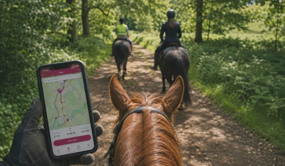

What is The Bridleways App
Finding a suitable, legal path for a horse is never as simple as opening a regular map. The Bridleways App, officially known as Bridlewayz, was built to solve exactly that problem for UK riders.
It combines interactive route mapping, ride tracking, and a rider community into a single free app. Riders use it to discover legal bridleways, record their hacks, and connect with other equestrians nearby.
Origin and Founder’s Story
That same problem is what led to the app’s creation in the first place. Bridlewayz was created by Belinda Palmer, an equestrian who struggled to find suitable riding routes after moving to a new area.
She wanted a simple way to locate bridleways and connect with local riders. That personal challenge led to an app dedicated entirely to horse riders, which launched in December 2021 and has since grown into a recognised name within the UK equestrian community.
How The Bridleways App Works
With that background in mind, the app’s design makes more sense. It uses an interactive map that overlays bridleways, footpaths, and byways onto a standard digital map.
Riders enter a starting point and destination, and the app displays available routes in that area. Once a route is selected, the built-in GPS tracks the ride in real time, and riders can save, review, or share the recorded path afterward.
Bridleways App Core Features Explained
This working mechanism becomes clearer once each feature is broken down individually.
Interactive Route Mapping
The map shows bridleways, footpaths, restricted byways, and traffic byways at any zoom level, helping riders plan a route before they set off.
GPS Ride Tracking
Rides are tracked with distance, duration, and path data, with tracking designed specifically for the speeds and movements of horse riding.
Digital Ride Logbook
Riders can keep a digital record of past hacks and training sessions, building a personal ride history they can revisit anytime.
Trailer Parking Locator
The app marks parking spots suitable for horse boxes and trailers near bridleways, removing the guesswork from planning longer rides.
Community Feed and Sharing
Riders can share photos, routes, and experiences with other users, making it easier to discover new areas through people who have already ridden them.
Understanding UK Rights of Way
These features are only useful if the underlying map data is legally accurate, which is why rights of way matter so much to riders.
Bridleways vs Footpaths vs Byways
A bridleway is legally open to horse riders, walkers, and cyclists. A footpath is generally restricted to walkers only, while a byway allows a wider range of users, including some vehicles.
Why Only Some Routes Are Accessible
England and Wales have around 120,000 miles of recorded public rights of way, but only about 27,000 miles of that network are actually open to equestrians.
Reliability and Real Limitations
Given how much this legal detail matters, it’s worth looking honestly at how the app performs in practice.
Our team tried the app across a few regions before writing this guide, and the experience varied noticeably by area. That hands-on use shaped much of what follows.
What Users Are Saying
Many riders report discovering new bridleways and footpaths near their homes through the app, particularly in well-mapped areas.
Common Issues Reported
Some users have noted slower performance in certain regions and occasional gaps in bridleway coverage compared to other mapping tools.
Risk of Unofficial Routes
Riders should be cautious, as some displayed paths may reflect where others have ridden rather than confirmed legal rights of way. Checking a local council’s Definitive Map remains the safest way to confirm legal access.
Best Suited For Which Riders
With those strengths and gaps in mind, the app naturally suits some riders more than others.
| Rider Type | Main Benefit |
| Leisure Riders | Discovering scenic, legal routes nearby |
| Competitive Equestrians | Tracking training rides and progress |
| Trail Explorers | Finding new areas beyond usual routes |
| Beginners and Pony Club Members | Learning safe, verified paths |
Connection With Local Businesses
Beyond routes, the app extends its usefulness by letting equestrian centres and livery yards list themselves on the map along with their services.
This turns a simple route planner into a broader directory, giving riders a way to find nearby instructors or arena hire without searching separately through social media or word of mouth.
Bridleways App Community Culture
That directory function ties directly into the app’s wider social presence. Bridlewayz maintains active accounts on Facebook and Instagram, where riders share rides, tips, and updates from the app.
This social layer turns the app into more than a mapping tool, giving riders a space to interact with others who share the same interest.
Common Myths vs Reality
Given how active this community is, a few misconceptions about the app have naturally spread along with it.
| Myth | Reality |
| Every route shown is a legal bridleway | Some routes may not be officially confirmed rights of way |
| The app works the same everywhere in the UK | Coverage quality can vary by region |
| It replaces official rights-of-way records | Council Definitive Maps remain the legal reference |
Bridleways App and Rider Safety
Clearing up these myths matters because route accuracy is directly tied to rider safety. Knowing which paths are legally open to horses reduces the risk of accidental trespassing or unsafe road crossings during a ride.
The trailer parking feature adds another layer of safety for longer trips, helping riders plan realistic routes with proper access points for loading and unloading horses.
What The Future Holds
As safety and accuracy continue to matter more to riders, the app’s direction will likely follow that demand. Apps like Bridlewayz are expected to keep expanding mapped coverage and community features.
Continued rider feedback will play a key role in closing existing gaps in bridleway data over time.
Frequently Asked Questions
Why Is It Called a Bridleway?
The term comes from “bridle,” the piece of equipment used to lead or guide a horse, reflecting the path’s original purpose as a route made for horse riders.
What Is the Best App for Horse Riding?
The right choice depends on individual needs, since some riders prioritise community features while others want detailed offline maps.
Is It Suitable for Every Rider?
It works well for most leisure and training riders, though those needing very detailed offline maps may want to compare other tools first.
Is the Bridleways App Free to Use?
Yes, the core app is free to download and use on both iOS and Android.
How Is It Different from Other Trail Apps?
Unlike general hiking or cycling apps, it is built around equestrian needs, such as trailer parking and horse-friendly routes.
Does It Work Outside the UK?
The app’s mapping data currently focuses on England and Wales, so coverage elsewhere is limited.
Conclusion
What makes Bridlewayz stand out isn’t just its map, but the fact that it was built by someone who lived the exact problem it now solves. That origin still shapes its focus on equestrian-specific details over generic trail data.
For riders willing to double-check unfamiliar routes against official records, it remains a practical tool built around how horses, not hikers, actually move through the countryside.
Disclaimer:
This article is for informational purposes only and reflects independent research and testing. Always verify bridleway routes against your local council’s official Definitive Map before riding.
Read more topics on :Instamagazine.co.uk